Distritos de Sri Lanka: qué son las 25 divisiones administrativas
Guía de los 25 distritos de Sri Lanka: organización en 9 provincias, funciones de los secretarios de distrito y estructura administrativa clara y concisa.
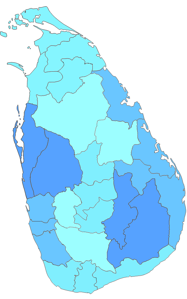
En Sri Lanka, los distritos (cingalés: දිස්ත්රික්ක, tamil: மாவட்டம்) son las divisiones administrativas de segundo nivel. El primer nivel son las provincias. Cada provincia contiene un número de distritos. Hay 25 distritos en el país. Están organizados en 9 provincias. Cada distrito es administrado por un Secretario de Distrito. Los secretarios son nombrados por el gobierno central.
Galería de imágenes
8 Imágenes


Qué es un distrito y cuál es su función
Un distrito en Sri Lanka actúa como unidad administrativa intermedia entre la provincia y las autoridades locales. Sus funciones principales incluyen la coordinación de la administración central en el territorio (a través del District Secretary, antes conocido como "Government Agent"), la gestión de emergencias y ayuda humanitaria, la supervisión de servicios públicos relacionados con la tierra y el registro, la implementación de políticas nacionales, y la cooperación con los órganos de gobierno local en asuntos de planificación y desarrollo.
Administración y organismos locales
El jefe administrativo del distrito es el Secretario de Distrito, funcionario nombrado por el gobierno central. A nivel local existen entidades electas encargadas de servicios municipales y rurales: Municipal Councils (consejos municipales), Urban Councils (consejos urbanos) y Pradeshiya Sabhas (consejos rurales). Además, los distritos se subdividen en unidades administrativas inferiores —las Divisional Secretariats— que actúan como oficinas locales del gobierno central y sirven para gestionar asuntos como registros, servicios sociales y proyectos de desarrollo.
Organización territorial interna
Cada distrito se divide en varias Divisional Secretariat Divisions (a veces abreviadas como DS Divisions), y éstas a su vez se subdividen en divisiones Grama Niladhari, que son las unidades más pequeñas de administración local encargadas del contacto directo con la población. En términos generales hay más de 300 divisiones a nivel de Divisional Secretariat y miles de divisiones Grama Niladhari en todo el país.
Lista de provincias y sus distritos
- Provincia Occidental
- Colombo
- Gampaha
- Kalutara
- Provincia Central
- Kandy
- Matale
- Nuwara Eliya
- Provincia Meridional
- Galle
- Matara
- Hambantota
- Provincia de Sabaragamuwa
- Ratnapura
- Kegalle
- Provincia de Uva
- Badulla
- Monaragala
- Provincia Noroeste (North Western)
- Kurunegala
- Puttalam
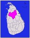
- Provincia Centro-Norte (North Central)
- Anuradhapura
- Polonnaruwa
- Provincia Norte
- Jaffna
- Kilinochchi
- Mannar
- Vavuniya
- Mullaitivu
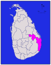
- Provincia Oriental
- Trincomalee
- Batticaloa
- Ampara
Breve reseña histórica
La organización por distritos se consolidó durante los periodos coloniales, especialmente con la administración británica, que estructuró el país en unidades administrativas para la recaudación, la justicia y la gobernanza. Tras la independencia, los distritos se mantuvieron como pilar de la administración, aunque han sufrido ajustes y cambios administrativos menores a lo largo del tiempo.
Usos prácticos y datos relevantes
- Los distritos son la referencia más habitual para estadísticas demográficas, electorales y de desarrollo.
- En temas electorales, la distribución de escaños y la organización práctica de las votaciones suelen articularse a nivel de distrito.
- En caso de desastres naturales o emergencias, la coordinación de ayuda y respuesta se organiza frecuentemente desde la oficina del Secretario de Distrito.
En resumen, los 25 distritos de Sri Lanka son piezas clave de la administración territorial: conectan las políticas nacionales con la realidad local y sirven de marco para la prestación de servicios públicos, la planificación y la representación local.
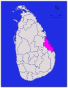
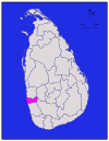
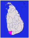
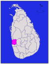
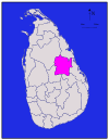
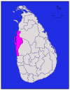
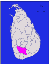
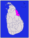
Distritos
Todas las cifras de población proceden del censo más reciente de Sri Lanka, en 2012. La densidad de población se ha calculado utilizando la superficie terrestre en lugar de la superficie total (la superficie total habría incluido la superficie de ríos y lagos).
| Distrito | Mapa de la zona | Provincia | DistritoCapital | Landareain | Aguas continentales a un | Total de | Población | Población por |
| Ampara |
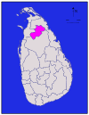
| Ampara | 4,222 (1,630) | 193 (75) | 4,415 (1,705) | 648,057 | 153 (400) | |
| Anuradhapura |
| Anuradhapura | 6,664 (2,573) | 515 (199) | 7,179 (2,772) | 856,232 | 128 (330) | |
| Badulla |
| Uva | Badulla | 2,827 (1,092) | 34 (13) | 2,861 (1,105) | 811,758 | 287 (740) |
|
| Batticaloa | 2,610 (1,010) | 244 (94) | 2,854 (1,102) | 525,142 | 201 (520) | ||
|
| Occidental | Colombo | 676 (261) | 23 (8.9) | 699 (270) | 2,309,809 | 3,417 (8,850) | |
| Galle |
| Sur | Galle | 1,617 (624) | 35 (14) | 1,652 (638) | 1,058,771 | 655 (1,700) |
| Gampaha |
| Occidental | Gampaha | 1,341 (518) | 46 (18) | 1,387 (536) | 2,294,641 | 1,711 (4,430) |
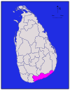
| Hambantota |
| Sur | Hambantota | 2,496 (964) | 113 (44) | 2,609 (1,007) | 596,617 | 239 (620) |
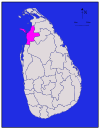
|
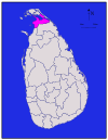
| Norte | 929 (359) | 96 (37) | 1,025 (396) | 583,378 | 628 (1,630) | ||
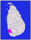
| Kalutara |
| Occidental | Kalutara | 1,576 (608) | 22 (8.5) | 1,598 (617) | 1,217,260 | 772 (2,000) |
| Kandy |
| Kandy | 1,917 (740) | 23 (8.9) | 1,940 (750) | 1,369,899 | 715 (1,850) | |
| Kegalle |
| Sabaragamuwa | Kegalle | 1,685 (651) | 8 (3.1) | 1,693 (654) | 836,603 | 497 (1,290) |
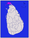
|
| Norte | Kilinochchi | 1,205 (465) | 74 (29) | 1,279 (494) | 112,875 | 94 (240) | |
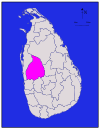
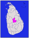
| Kurunegala |
| Kurunegala | 4,624 (1,785) | 192 (74) | 4,816 (1,859) | 1,610,299 | 348 (900) | |
|
| Norte | Mannar | 1,880 (730) | 116 (45) | 1,996 (771) | 99,051 | 53 (140) | |
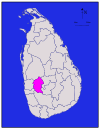
| Matale |
| Matale | 1,952 (754) | 41 (16) | 1,993 (770) | 482,229 | 247 (640) | |
| Matara |
| Sur | Matara | 1,270 (490) | 13 (5.0) | 1,283 (495) | 809,344 | 637 (1,650) |
| Moneragala |
| Uva | Moneragala | 5,508 (2,127) | 131 (51) | 5,639 (2,177) | 448,142 | 81 (210) |
|
| Norte | Mullaitivu | 2,415 (932) | 202 (78) | 2,617 (1,010) | 91,947 | 38 (98) | |
| Nuwara Eliya |
| Nuwara Eliya | 1,706 (659) | 35 (14) | 1,741 (672) | 706,588 | 414 (1,070) | |
| Polonnaruwa |
| Polonnaruwa | 3,077 (1,188) | 216 (83) | 3,293 (1,271) | 403,335 | 131 (340) | |
| Puttalam |
| Puttalam | 2,882 (1,113) | 190 (73) | 3,072 (1,186) | 759,776 | 264 (680) | |
| Ratnapura |
| Sabaragamuwa | Ratnapura | 3,236 (1,249) | 39 (15) | 3,275 (1,264) | 1,082,277 | 334 (870) |
|
| Trincomalee | 2,529 (976) | 198 (76) | 2,727 (1,053) | 378,182 | 150 (390) | ||
|
| Norte | Vavuniya | 1,861 (719) | 106 (41) | 1,967 (759) | 171,511 | 92 (240) | |
| Total | 62,705 (24,211) | 2,905 (1,122) | 65,610 (25,330) | 20,263,723 | 323 (840) |


Preguntas y respuestas
P: ¿Qué son los distritos en Sri Lanka?
R: En Sri Lanka, los distritos son las divisiones administrativas de segundo nivel.
P: ¿Cuál es el primer nivel de divisiones administrativas en Sri Lanka?
R: El primer nivel de divisiones administrativas en Sri Lanka son las provincias.
P: ¿Cuántos distritos hay en Sri Lanka?
R: Hay 25 distritos en Sri Lanka.
P: ¿Cuántas provincias hay en Sri Lanka?
R: Hay 9 provincias en Sri Lanka.
P: ¿Quién administra cada distrito en Sri Lanka?
R: Cada distrito de Sri Lanka está administrado por un Secretario de Distrito.
P: ¿Quién nombra a los Secretarios de Distrito en Sri Lanka?
R: El Gobierno central nombra a los secretarios de distrito en Sri Lanka.
P: ¿Cómo se denominan las divisiones administrativas en cingalés y tamil en Sri Lanka?
R: Las divisiones administrativas en Sri Lanka se conocen como "දිස්ත්රික්ක" en cingalés y "மாவட்டம்" en tamil.
Artículos relacionados
Autor
AlegsaOnline.com Distritos de Sri Lanka: qué son las 25 divisiones administrativas Leandro Alegsa
URL: https://es.alegsaonline.com/art/27771
Fuentes
- commons.wikimedia.org : Districts of Sri Lanka
- priu.gov.lk : "At a Glance"
- ds.gov.lk : "Vision & Mission" · web.archive.org
- archives.dailynews.lk : "Kilinochchi a brief look"